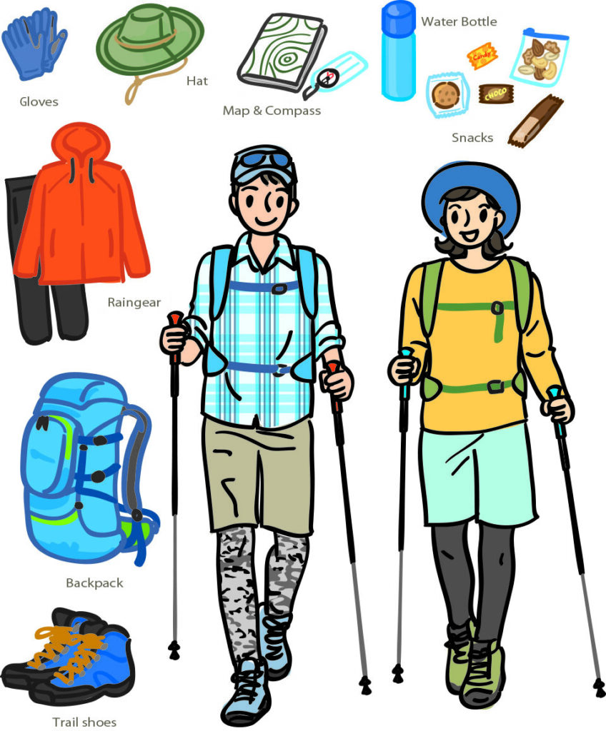
Prefectural Border Trailhead→15min, approx.0.5㎞→Mt. Hachimantai Summit→10min, approx.0.4㎞→Hachiman-numa – Gama-numa Observatory→10min, approx.0.4㎞→Mikaeri Ridg→10min, approx.0.5㎞→Prefectural Border Trailhead
Travel Time 55min, approx. 2.4km total
Prefectural Border Trailhead→15min, approx.0.5㎞→Mt. Hachimantai Summit→10min, approx.0.4㎞→Hachiman-numa – Gama-numa Observatory→10min, approx.0.4㎞→Ryounso→5min, approx.0.3㎞→Genta-Wakare→10min, approx.0.5㎞→Gentamori→10min, approx.0.5㎞→Genta-Wakare→25min, approx.1.1㎞→Mikaeri Ridge→10min, approx.0.5㎞→Prefectural Border Trailhead
Travel Time 1hr 50min, approx. 4.9km
Kuroyachi-Iriguchi→15min, approx.0.5㎞→Kuroyachi Wetlands→40min, approx.1.5㎞→Gentamori→10min, approx.0.5㎞→Genta-Wakare→15min, approx.0.5㎞→Ryounso→5min, approx.0.3㎞→Hachiman-numa – Gama-numa Observatory→10min, approx.0.4㎞→Mt. Hachimantai Summit→25min, approx.1.1㎞→Prefectural Border Trailhead
Travel Time 1hr 45min, approx. 4.3km
Chausu-Guchi→40min, approx.1.2㎞→Chausu-Sanso→5min, approx.0.2㎞→Mt. Chausu Observatory→5min, approx.0.2㎞→Chausu-Sanso→25min, approx.1.3㎞→Kuroyachi Wetlands→40min, approx.1.5㎞→Gentamori→10min, approx.0.5㎞→Genta-Wakare→15min, approx.0.5㎞→Ryounso→5min, approx.0.3㎞→Hachiman-numa – Gama-numa Observatory→10min, approx.0.4㎞→Mt. Hachimantai Summit→25min, approx.1.1㎞→Prefectural Border Trailhead
Travel Time 3hrs, approx. 7.2km